
-About NTR District-
The Heart of Andhra Pradesh
The Glorious History of NTR District

Sathavahan Dynasty-
The region that now forms NTR District was an important part of the Satavahana Empire, one of the earliest and most influential dynasties in South India. The Satavahanas ruled large parts of the Deccan from approximately 1st century BCE to 3rd century CE, fostering economic prosperity, cultural growth, and political stability. Situated along the fertile banks of the Krishna River, the area around present-day Vijayawada served as a vital center for agriculture, trade, and transportation. The Satavahanas developed extensive trade networks that connected the region with other parts of India and foreign lands, promoting the exchange of goods, ideas, and culture.
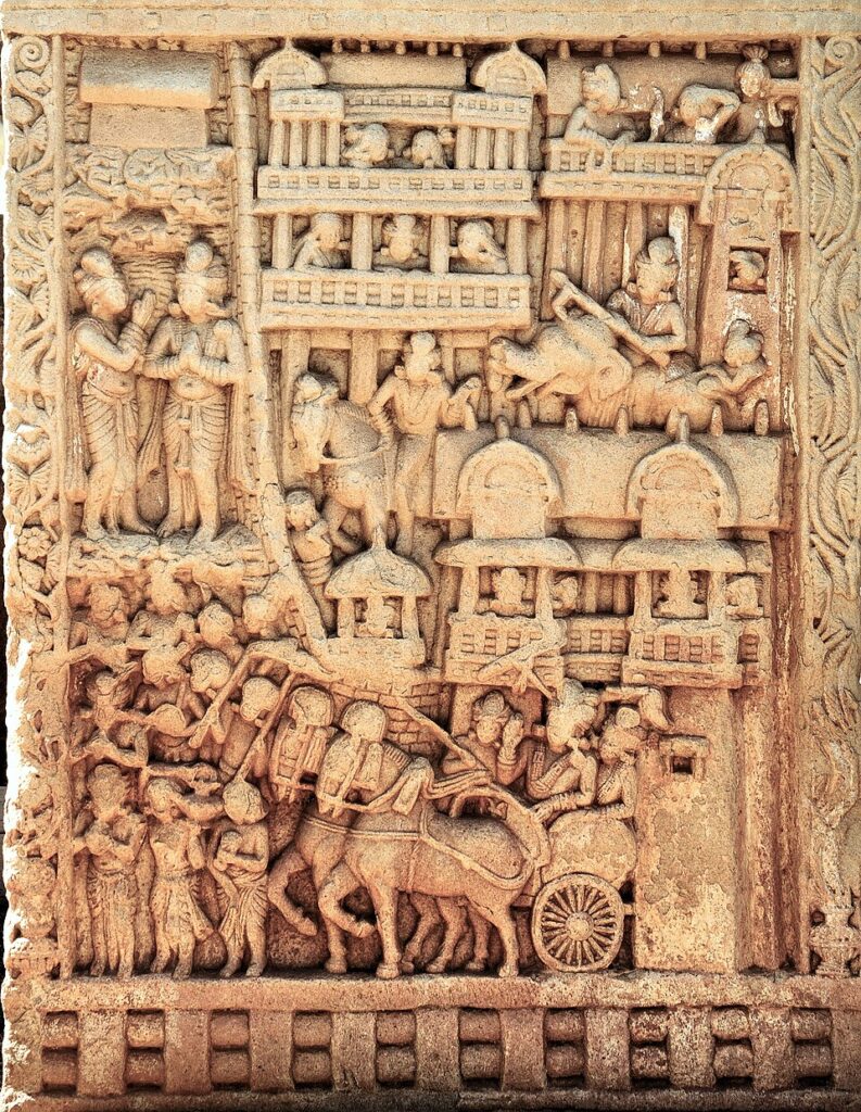
The dynasty was known for its patronage of Buddhism and Hinduism, leading to the construction of religious monuments, stupas, and educational centers throughout the Krishna Valley. Archaeological findings, including coins, inscriptions, and ancient artifacts discovered in the region, provide evidence of the Satavahana influence on local society and administration.
Under Satavahana rule, the Krishna River basin flourished as a center of commerce and culture. The dynasty’s contributions to trade, irrigation, governance, and religious harmony laid the foundation for the development of the region, leaving a lasting legacy that continues to shape the historical identity of NTR District.
The Satavahana Dynasty laid the foundation for the social, economic, and cultural growth of the region that is now NTR District. Through their support of trade, agriculture, religion, and governance, they transformed the Krishna Valley into a thriving center of civilization, leaving behind a legacy that continues to be remembered as a golden chapter in the district’s ancient history.
Ikshvaku Dynasty
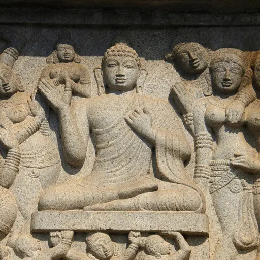
After the decline of the Satavahana Empire, the Ikshvaku Dynasty (3rd–4th century CE) emerged as a powerful ruling dynasty in the Krishna River valley. The Ikshvakus established their authority over large parts of present-day Andhra Pradesh and played a vital role in preserving political stability and promoting cultural advancement in the region that now forms NTR District.
The Ikshvaku rulers were renowned patrons of both Buddhism and Hinduism, supporting the construction of temples, monasteries, stupas, and educational institutions. Their generous patronage helped transform the Krishna Valley into an important center of religious learning and spiritual activity. Buddhist monks, scholars, and pilgrims visited the region, contributing to the spread of knowledge and cultural exchange.
District Overview
NTR District was newly proposed district is named as NTR District as a mark of respect and recognition of the of the stellar contribution of Sri Nandamuri Taraka Rama Rao Garu, who officiated for 3 times as a Chief Minister of Combined Andhra Pradesh. NTR District with its district head quarters at Vijayawada formerly called as Bezawada.
The District is divided into 20 Mandals covering 3 Revenue Divisions viz., 1.Vijayawda 2. Nandigama 3. Tiruvuru. The District is naturally Upland Zone. The upland consists of an undulating broken by low ranges of Eastern Ghats. (The main sources of Irrigation in upland are tanks. It is being benefited by the water of Nargarjuna Sagar also The delta land is being irrigated by canals of river Krishna.
The population of the District is 2218591 comprising of 305 inhabited and 16 uninhabited villages. There are 4 Municipalities viz., 1. Tiruvuru 2. Nandigama 3. Jaggayyapeta 4. Ibrahimpatnam and one Municipal Corporation in Vijayawada.
PHYSICAL CHARACTERISTICS
- Latitude 16° 86’ N and 17° 14’ N
- Longitude 15° 71’ E and 16° 47’ of E
AREA
- 3316 Sq. Kms
BOUNDARIES
- East – Eluru District
- West – Guntur and Nalgonda Districts
- North – Khammam District
- South – Krishna
CLIMATE
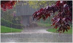
Tropical Climate conditions with extreme hot summer and cold winter prevail in this district. April to June is the hottest months with high temperature in May. The monsoon usually breaks in the middle of June and brings good rains up to middle of October. The normal rainfall of this district is 1035.1 M.M, 2/3 rds of which is received through the South West monsoon. The average rainfall recorded during the 2019-20 it is 761.00 M.M.
SOILS

Three types of soils viz., 1. Black soil which constitute 57.6% of the villages 2. Sandy Clay-loams with 22.3% and 3. Red loamy with 19.4% of the villages are prevalent in this district, while a small sandy soils constitute 0.7% fringes on the sea coast.
AGRICULTURE

Endowed with a rich variety of soils, the district occupies an important place in Agriculture which is the most important occupation and paddy is the main food crop produced. While 2019-20 the gross cropped area of the district was 2.15 Lakh Hects of which gross irrigated area was 1.08 lakh Hects.
LITERACY

NTR District has recorded a literacy of 74.43 as per 2011 census. This district is much advanced in the field of education. Almost all the villages in the district are having primary schools. NTR Medical University is located at Vijayawada.
Major Towns of District
Vijayawada
Vijayawada is the largest and most important city in NTR District. Located on the banks of the Krishna River, it is district headquarters
Nandigama
Nandigama is a prominent town in NTR District known for its agricultural significance, growing infrastructure.
Jaggaiahpet
Jaggayyapeta is a major town in NTR District known for its rich history, limestone reserves, and thriving cement industry.
Mylavaram
Mylavaram is a prominent town in NTR District known for its agricultural activities, educational institutions, and scenic surroundings.
Population and Demographic Insights
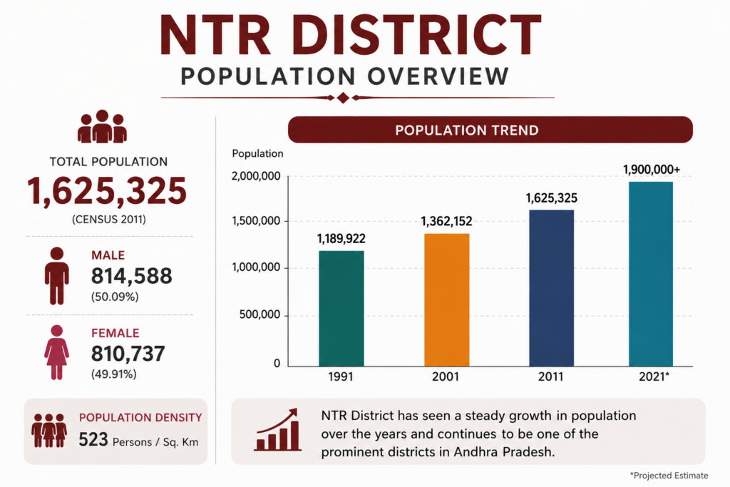
NTR District is a vibrant and growing district with a population of over 1.6 million people. The district enjoys balanced demographic growth, strong urban development, and a thriving economy driven by agriculture, industry, education, and commerce. As one of Andhra Pradesh’s key districts, NTR District continues to attract people and opportunities, contributing to its steady population growth and overall development.
Key Highlights
Total Population: 1,625,325 (Census 2011)
Male Population: 814,588 (50.09%)
Female Population: 810,737 (49.91%)
Population Density: 523 persons per sq. km
District Headquarters: Vijayawada
Growth Drivers: Urbanization, Education, Industry, Trade, and Infrastructure
Geographical Area
NTR District spans approximately 3,316 square kilometers and is strategically located along the Krishna River. The district comprises fertile agricultural lands, growing urban centers, industrial hubs, and well-developed infrastructure, making it a key contributor to the economic and social development of Andhra Pradesh.
Key Facts
- Total Area: 3,316 Sq. Km
- District Headquarters: Vijayawada
- Major River: Krishna River
- Major Towns: Vijayawada, Nandigama, Jaggayyapeta, Mylavaram, Tiruvuru
- Key Land Use: Agriculture, Urban Development, Industry, Infrastructure, Water Resources
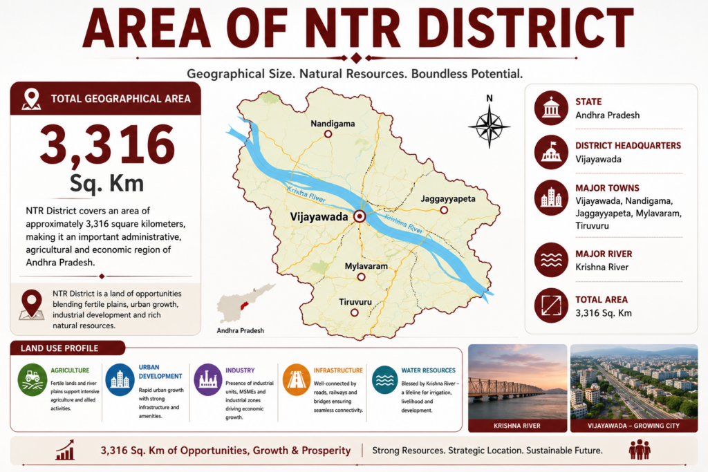
Facts & Figures of NTR District
| Statistic | Value |
|---|---|
| Area | 3,316 Sq. Km |
| Population | 22,18,591 |
| Literacy Rate | 74.43% |
| Revenue Divisions | 3 |
| Mandals | 20 |
| Major River | Krishna River |
| Headquarters | Vijayawada |
| Urban Population | 58.71% |
| Municipal Corporation | 1 |
| Municipalities | 4 |
Revenue Overview
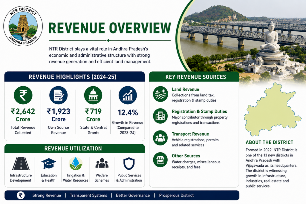
The Revenue Administration of NTR District plays a vital role in maintaining land records, implementing government welfare schemes, disaster management, and ensuring efficient public administration. Headquartered in Vijayawada, the district’s revenue system is designed to provide accessible and transparent services to citizens.
- District Headquarters: Vijayawada
- Revenue Divisions: 3
- Total Mandals: 20
- Revenue Divisions: Vijayawada, Nandigama, and Tiruvuru
- Head of Revenue Division: Revenue Divisional Officer (RDO)/Sub-Collector
- Mandal Administration: Managed by Tahsildars who oversee land administration and citizen services.